
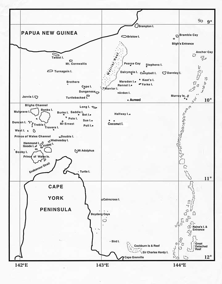
Map of the Torres Strait as it looked to mariners in the second half of the 19th century. All the islands and cays still have their European names. Rains Island with its lighthouse, and the Detached Reef are now clearly laid down.
Map of the Torres Strait as it looked to mariners in the second half of the 19th century. All the islands and cays still have their European names. Rains Island with its lighthouse, and the Detached Reef are now clearly laid down.


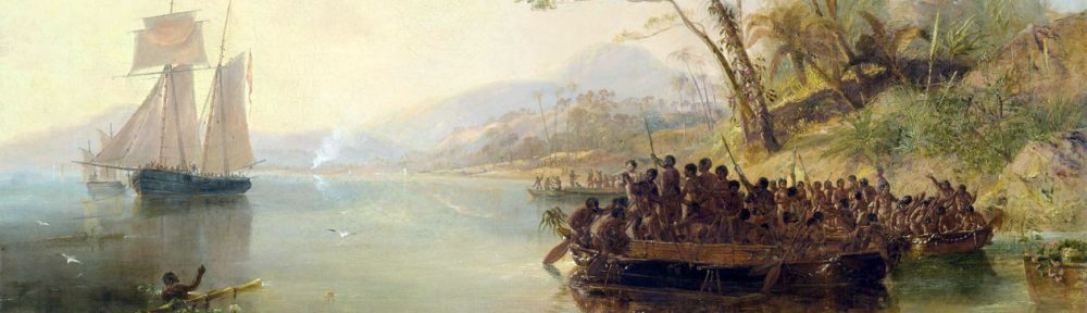